
The complete guide for UK travellers: Kathmandu honestly assessed, which trek is right for your fitness level, the Annapurna Circuit vs Everest Base Camp vs Poon Hill answered properly, the altitude question dealt with directly, what permits cost and where to buy them, the Chitwan jungle that most people skip, and why Nepal is the most extraordinary walk-accessible mountain landscape on Earth.
Reading time: 18 minutes | Last updated: 2025
Nepal is the only country I’ve been to where every single view makes you stop moving.
Not metaphorically. You’re walking a trail and the path rounds a corner and the Annapurna range — eight peaks above 7,000 metres, arranged along the horizon like something a child drew when asked to draw mountains — appears in full. And you stop. Not because you decide to. Because your legs stop first.
This happens repeatedly. At Poon Hill at dawn, when the Dhaulagiri and Machhapuchhre and the entire Annapurna massif emerge from the dark simultaneously as the sky behind them turns pink, then orange, then gold. At the Tengboche Monastery on the EBC trail, when you round the ridge at 3,867 metres and the south face of Everest appears above the monastery roof. At Phewa Lake in Pokhara at 6am, when the water is still and the reflection of Machhapuchhre — the sacred, unclimbed Fishtail Mountain — appears as a perfect inverted pyramid below its actual self.
Nepal has eight of the world’s fourteen 8,000-metre peaks. It has approximately 1,300 trekking trails. It has a permit system, an altitude consideration, and a logistics infrastructure that rewards preparation but doesn’t require it to be extreme.
This guide is for the traveller who wants to understand Nepal properly before deciding which version of it to experience — whether that’s four days at Poon Hill on an introductory Himalayan trek, fourteen days on the Everest Base Camp route, or three weeks completing the full Annapurna Circuit. It’s also honest about Kathmandu — what it is, what it isn’t, and how much time it warrants.
Quick Navigation
- The Case for Nepal — The Mountain Context
- When to Go — The Two Windows and the Monsoon Truth
- The Altitude Question — Nepal Specific
- The Permits — What You Need and Where to Get Them
- Kathmandu — 48 Hours, Honestly Assessed
- The Kathmandu Valley — Bhaktapur and Patan
- Pokhara — The Trekking Gateway
- Which Trek — The Honest Guide to Choosing
- Poon Hill — The Best Introductory Himalayan Trek
- The Annapurna Circuit — The Full Loop
- Everest Base Camp — The Greatest Walk on Earth
- The Langtang Valley — The Trek Most People Don’t Know
- Chitwan National Park — The Jungle Below the Mountains
- Lumbini — The Birthplace of the Buddha
- What It Costs — Real Numbers
- Eating in Nepal — Dal Bhat and Everything Else
- Practical Notes
- Two Itineraries — Two Weeks and Three Weeks
The Case for Nepal — The Mountain Context
Nepal occupies a strip of land 150km wide and 800km long on the southern slope of the Himalayas. In that strip: eight of the fourteen mountains on Earth above 8,000 metres (Everest, Kangchenjunga, Lhotse, Makalu, Cho Oyu, Dhaulagiri, Manaslu, Annapurna), thousands of peaks above 6,000 metres, and a system of trekking trails that connects them with tea houses and lodges every few hours of walking.
The mountain infrastructure of Nepal is extraordinary. You can walk for 14 days on the Everest Base Camp route sleeping every night in a lodge, eating from a menu, showering (cold, but available), and charging your phone. No tent. No stove. No guide required for the well-marked main routes. The style is called teahouse trekking and it has made the Himalayan experience accessible to a range of fitness levels and budget profiles that no other mountain region on Earth replicates.
This accessibility is not a diminishment. The mountains don’t become less extraordinary because you sleep in a lodge rather than a tent. The Khumbu glacier at dawn doesn’t become less significant because you ate momos for dinner the night before. The accessibility is what allows the experience — which is, without qualification, among the finest travel experiences available from the UK — to be available to travellers who are not mountaineers.
The practical case: direct flights from London to Kathmandu don’t exist. The best routing is via the Gulf (Dubai on Emirates, Doha on Qatar Airways, Abu Dhabi on Etihad — connections 6-7 hours in total flying time from London, with a 1-3 hour connection). Return flights from £450-700 depending on advance booking and season.
When to Go — The Two Windows and the Monsoon Truth
Nepal has two main trekking seasons and one significant factor that closes significant sections of the mountain trails.
October to November — The Prime Window
The finest trekking months. The monsoon ends in late September, leaving the landscape washed clean and the sky consistently clear. The October light — low angle, deep golden, the Himalayan shadows defined — is the light in most Nepal photographs. The trails are busy relative to other months but the teahouses are open and fully stocked. November brings colder nights at altitude (sub-zero above 4,000m) and the first dusting of snow on the higher passes.
March to May — The Second Window
The spring trekking season. The rhododendrons bloom on the lower hillsides in March and April — the Annapurna foothills turn vivid pink and red. The days are warmer than autumn. The skies are clear in the mornings and cloud over in the afternoon — the EBC summit and passes are often clear in the morning, partly cloudy by afternoon. May sees the pre-monsoon haze building, reducing visibility on the high trails.
June to September — The Monsoon
The monsoon is real and significant. Heavy rain falls daily (often for 3-6 hours), the trails in the lower elevations become muddy and leech-populated, and many teahouses close or reduce services. The exception: the Mustang region (Upper Mustang) and the Manang and Nar-Phu valleys lie in the rain shadow of the Annapurna massif and remain dry during the monsoon. They’re expensive to enter (special permit required) but they’re the correct destination for a Nepal trip in the monsoon window.
The BGGD recommendation: October for clear skies, ideal temperatures, and the best photography light. March for rhododendrons and quieter trails on the popular routes.
The Altitude Question — Nepal Specific
Nepal’s altitude situation is different from Peru in one important respect: the trekking routes are designed with acclimatisation built in. The standard Everest Base Camp schedule adds two acclimatisation days (rest days or short hikes to higher altitude before returning to sleep lower) at Namche Bazaar and Dingboche. The Annapurna Circuit crosses the Thorong La pass (5,416m) after a week of gradual ascent that allows proper adaptation.
The risks are real. Acute Mountain Sickness (AMS), High Altitude Pulmonary Oedema (HAPE), and High Altitude Cerebral Oedema (HACE) are all potentially serious above 3,500m. They’re also largely preventable with the right approach.
The rules that matter:
Ascend gradually. The standard guideline above 3,000m is to gain no more than 300-500 metres of sleeping altitude per day. The EBC teahouse schedule follows this if you resist the urge to move faster than the schedule allows.
The rule of “climb high, sleep low.” On acclimatisation days, you hike to higher altitude than your lodging for the night and return. This stimulates red blood cell production without the risk of sleeping at too-high altitude.
Don’t push through symptoms. The symptoms of mild AMS — headache, fatigue, reduced appetite, poor sleep — are normal and expected. The response: stay at the same altitude until symptoms pass. The symptom that requires immediate descent: ataxia (loss of coordination, inability to walk in a straight line), altered consciousness, or breathlessness at rest. These indicate HAPE or HACE and require descent immediately, not the next morning.
Diamox (acetazolamide): widely used by trekkers to prevent and reduce AMS symptoms. Consult your GP before the trip. Standard dose is 125-250mg twice daily, starting 24-48 hours before ascending above 3,000m. It causes increased urination and mild tingling in the extremities — both normal side effects.
Rescue: helicopter rescue is available in Nepal and is the correct response to serious altitude illness. It’s expensive (£2,000-5,000) — ensure your travel insurance covers emergency helicopter evacuation, specifically at high altitude. Most specialist travel insurance policies do; standard UK travel insurance often does not. Check the altitude limit explicitly.
The Poon Hill distinction: Poon Hill (3,210m) is significantly lower than the EBC route’s highest points (5,364m at Base Camp, 5,545m at Kala Patthar). Altitude sickness at Poon Hill is possible but much less likely than on the EBC or Annapurna Circuit. The introductory trek is genuinely accessible for travellers without altitude experience.
The Permits — What You Need and Where to Get Them
Nepal’s trekking permit system changed significantly in 2023 with the introduction of the TIMS (Trekkers’ Information Management System) card and various area-specific permits. The current system (verify before travel as it changes):
TIMS Card Required for all trekking in Nepal. Available from the Nepal Tourism Board office in Kathmandu (Bhrikutimandap, near Thamel) or from the TAAN (Trekking Agencies’ Association of Nepal) office. Cost: £10 for individual trekkers. You need a passport photo. If trekking with a registered agency, they handle the TIMS.
Annapurna Conservation Area Permit (ACAP) Required for all trekking in the Annapurna region (Poon Hill, Annapurna Circuit, Annapurna Base Camp, Nar-Phu). Cost: £20. Available from the TAAN office in Kathmandu or from the permit checkpoint at Besisahar (Annapurna Circuit) or Nayapul (Poon Hill). The permit funds conservation work in the area.
Sagarmatha National Park Permit Required for the Everest Base Camp trek (all of the Khumbu region is inside Sagarmatha National Park). Cost: £25. Available at the National Park entry gate at Monjo, on the trail — you don’t need to arrange this in Kathmandu if you’re trekking independently.
Langtang National Park Permit Required for Langtang Valley trekking. Cost: £20. Available at the park gate.
Special Permits Upper Mustang, Nar-Phu Valley, Dolpo, Kanchenjunga, Manaslu Circuit — all require restricted area permits that cost significantly more (£50-700 depending on the area and season) and must be obtained in Kathmandu with a registered guide. These are the permit-controlled areas that add exclusivity to already-extraordinary destinations.
Trekking without a guide: The main routes (EBC, Annapurna Circuit, Poon Hill, Langtang) are well-marked and have been done independently by hundreds of thousands of trekkers. A guide is not legally required on these routes. However: a guide provides navigation support (useful in poor visibility), carries emergency knowledge, can arrange additional accommodation if you need to stop unexpectedly, and provides context about the communities and geography you’re walking through. A guide costs £20-35/day. A porter (who carries your bag, allowing you to focus on the terrain) costs £12-18/day. Both are worth considering seriously for EBC and Annapurna Circuit; less critical for Poon Hill.
Kathmandu — 48 Hours, Honestly Assessed
Kathmandu is not a beautiful city. This needs to be said before anything else, because the photographs that circulate of Nepal show Himalayan peaks and monastery prayer flags and the answer is: yes, but first you land in Kathmandu.
The city is chaotic, polluted (air quality is poor — an N95 mask is not excessive during heavy traffic hours), and crammed with 1.4 million people across a bowl-shaped valley at 1,400m. The roads are narrow and busy. The old city areas are densely populated and require active navigation.
It is also one of the most historically and spiritually dense places on Earth. Buddhist and Hindu traditions overlap here in a way that doesn’t happen in quite the same form anywhere else. The Boudhanath Stupa — a 36-metre mandala circumambulated by monks, pilgrims, and local residents throughout the day — operates as a living religious site, not a museum. The Pashupatinath ghats — where open-air Hindu cremation ceremonies take place on the Bagmati River, watched by respectful visitors from the opposite bank — are as significant a site in Hinduism as the Ganges at Varanasi. Both of these sites, within a 20-minute walk of each other, represent something that exists almost nowhere else accessible from the UK.
48 hours is the right allocation. Enough to see what matters. Not enough to get ground down by the noise.
Day One in Kathmandu
Morning: Boudhanath (6am)
At 6am, before the city wakes, the stupa is circled by monks completing their morning prayers. The butter lamps are lit at the shrine alcoves around the base. The sound: chanting, the turning of prayer wheels, the bells. The scale of the stupa from the inner circuit is different from the aerial photographs — from below, the dome is enormous and the eyes of the Buddha painted on each of the four faces watch every direction simultaneously.
The rooftop cafes surrounding the stupa open at 6:30am. Butter tea (made from black tea, yak butter, and salt — an acquired taste that makes complete sense at altitude) and the stupa below as the city wakes. This is the finest morning hour available in Kathmandu.
Midday: Pashupatinath
15 minutes on foot from Boudhanath. One of the holiest Hindu temples in the world — the Pashupatinath temple complex on the Bagmati River. The temple itself is accessible only to Hindus. The ghats (stone steps leading to the river) on both banks are accessible to all.
Open-air cremation ceremonies take place on the ghats throughout the day. The correct approach: watch from the opposite bank, maintain a respectful distance, do not photograph individual grieving families. The sight of the pyres, the priests, the river, and the temple complex beyond — all functioning simultaneously in the afternoon light — is one of the most affecting things available in Nepal.
Afternoon: Swayambhunath (Monkey Temple)
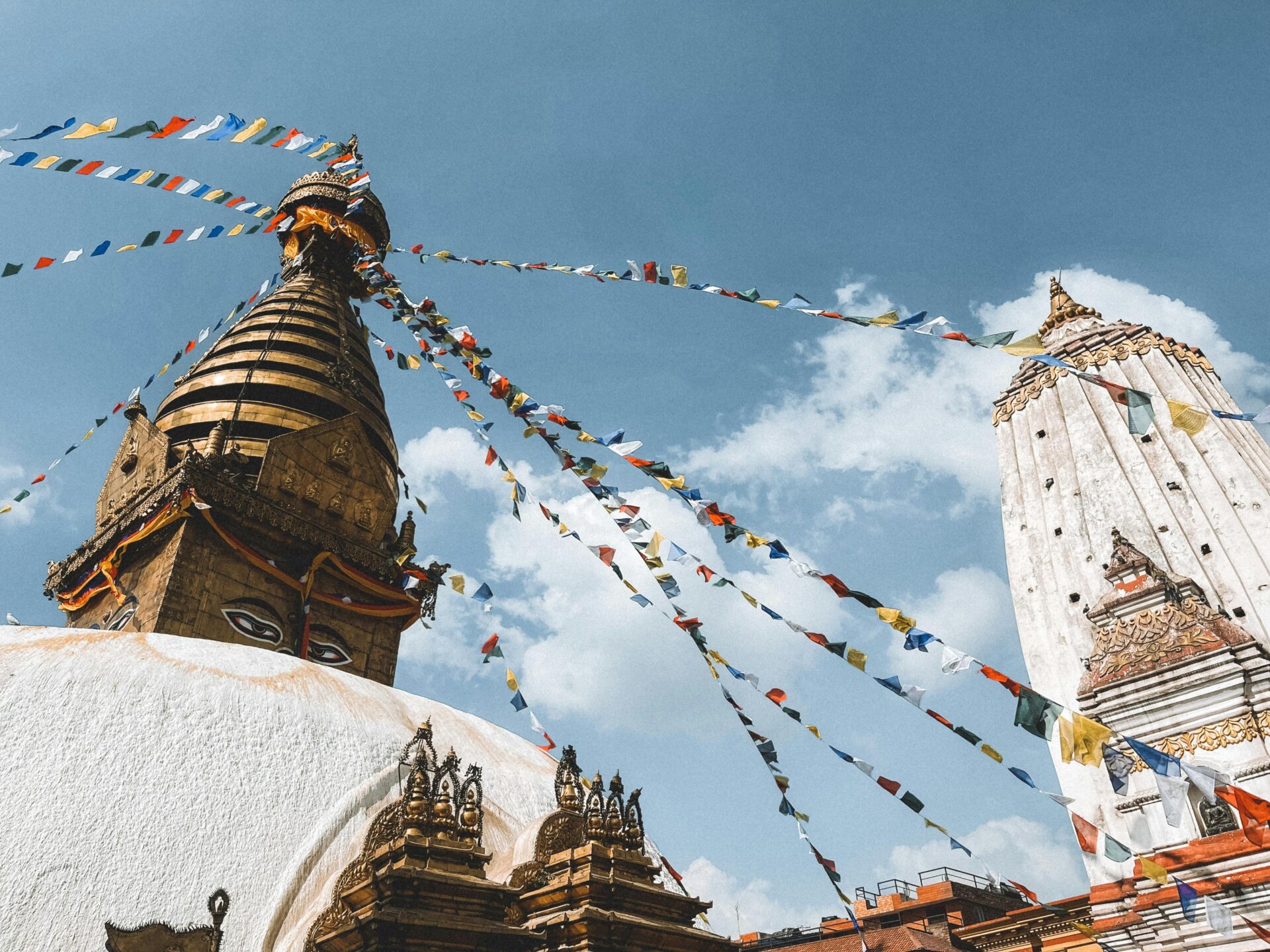
A Buddhist stupa on a hilltop above the Kathmandu Valley, reached by 365 stone steps from the base. The rhesus macaques that live in the temple complex are not shy — secure any food before you begin the climb. The view from the summit over the Kathmandu Valley — the city spread across the bowl, the mountains just visible through the haze — gives the geographic context that makes the rest of the valley comprehensible.
Evening: Thamel
The tourist district — a maze of narrow lanes with gear shops, restaurants, thangka painting studios, and music bars. The North Face and Mammut fakes (some of extraordinary quality, some terrible — inspect carefully and haggle on everything) are the Thamel attraction for most trekkers. Dinner at Thamel House (traditional Newari food in a restored courtyard building, set menu, £6-9/person) or at one of the rooftop restaurants on Tridevi Marg.
Day Two in Kathmandu
Morning: Kathmandu Durbar Square
The old royal palace complex at the centre of the city. Badly damaged in the 2015 earthquake (the Kasthamandap temple and several other structures were destroyed; restoration is ongoing). Entry: £8. The Kumari Ghar — the palace of the living goddess Kumari, a prepubescent girl selected through elaborate ritual who lives within the palace until puberty — is visible from the courtyard, the Kumari occasionally appearing at the upper window to acknowledge worshippers.
The durbar square area is honest about its earthquake damage, which makes it more interesting rather than less. The contrast between the fully restored structures and the scaffolded restoration work in progress gives a sense of living heritage rather than a static museum.
Afternoon: Bhaktapur (see next section)
The medieval city 13km east of Kathmandu. The best thing in the Kathmandu Valley by some margin.
The Kathmandu Valley — Bhaktapur and Patan
Bhaktapur
A UNESCO-listed medieval Newari city-state that maintained political independence from Kathmandu until 1769. The historical separation shows: Bhaktapur is significantly better preserved than Kathmandu’s own Durbar Square, quieter, and more coherent as an urban experience.
Entry: £8. This entry fee directly funds the city’s preservation (Bhaktapur has been managing its own tourist revenue for restoration since the 1970s, a model that’s been more successful than most). Arrive by 9am before the day-trip groups from Kathmandu.
The Durbar Square: the 55-Window Palace (a 14th-century royal palace with 55 intricately carved wooden windows), the Nyatapola Temple (a five-storey pagoda temple, the tallest in Nepal at 30 metres, built in 1702 and survived the 2015 earthquake largely intact), the Bhairav Nath temple. The craftsmanship of the woodcarving — peacocks, erotic couplings, mythological figures — is the finest medieval woodwork in South Asia.
The Potters’ Square: working potters making traditional wares in the open square, the same designs produced the same way for centuries. You can buy directly from the maker. The juju dhau (king curd) sold at the curd shops adjacent is the finest yoghurt in Nepal — thick, creamy, eaten from a clay pot.
Patan (Lalitpur)
Immediately south of Kathmandu (25 minutes by taxi, £3-4). A second former city-state with a Durbar Square that some consider finer than both Kathmandu’s and Bhaktapur’s — the temples here are less damaged and the Golden Temple (Hiranya Varna Mahavihar, a 12th-century Buddhist monastery with a golden facade) is one of the finest buildings in the valley.
The Patan Museum in the Durbar Square: the finest museum in Nepal, covering Hindu and Buddhist metalwork from across the valley. Entry: £5. The courtyard garden is where Pokhara-bound travellers should eat lunch — the café in the restored courtyard serves excellent momos and dal bhat at reasonable prices.
Pokhara — The Trekking Gateway
Pokhara is the second city of Nepal and the base for all Annapurna region trekking. It sits at 800m above sea level, 5 hours west of Kathmandu by tourist bus (£6-8) or 25 minutes by domestic flight (£45-65, book ahead).
The city is significantly more pleasant than Kathmandu — lower population, lower pollution, the Phewa Lake at its centre, and the Annapurna range visible above the city on clear mornings in a way that makes breakfast a different experience every day depending on how much cloud there is.
Phewa Lake at dawn:
Rent a rowing boat from the lakeside ghats at 6am (£1-2/hour). Row out to the centre of the lake as the light arrives. On clear mornings — most mornings in October and March — Machhapuchhre (Fishtail Mountain, 6,993m, considered sacred and never officially summited) reflects in the still water with a geometric precision that makes the photograph look manipulated. It isn’t.
The reflection disappears as the wind picks up around 8am. The boat is at 6am or the reflection isn’t the same.
The World Peace Pagoda:
A Japanese Buddhist stupa on a ridge above the south shore of the lake, accessible by boat and a 45-minute uphill walk. The view from the pagoda takes in Phewa Lake below, the city of Pokhara spread along the valley, and the Annapurna range rising directly behind. This is the view that makes the boat and the walk worthwhile and appears on almost no Pokhara content despite being the finest vantage point above the city.
The Pokhara gear market (Lakeside):
Every Nepal trekking essential is available in the Lakeside area of Pokhara — walking poles, sleeping bags, thermal layers, gaiters. The quality ranges from genuine North Face (from the licensed Kathmandu outlet) to convincing-from-a-distance imitation. Budget £25-60 for a week’s trekking gear supplement if you didn’t bring everything from home. The poles are worth buying here — cheap, effective for the descent.
Which Trek — The Honest Guide to Choosing
The single most common Nepal planning question is: Annapurna or Everest? The honest answer depends on what you’re optimising for.
| Factor | Poon Hill | Annapurna Circuit | Everest Base Camp |
|---|---|---|---|
| Duration | 4-5 days | 14-21 days | 12-14 days |
| Max altitude | 3,210m | 5,416m (Thorong La) | 5,364m (Base Camp) / 5,545m (Kala Patthar) |
| Difficulty | Moderate | Challenging | Moderate-Challenging |
| Crowds | Moderate | Light-Moderate | Busy (main trail) |
| Flight required | No (bus from Pokhara) | No (bus from Pokhara) | Yes (Lukla flight) |
| Access to Everest views | No | No | Yes |
| Village culture | Gurung | Gurung, Manangi, Mustangi | Sherpa |
| Best for | First Himalayan trek | Experienced trekkers | Bucket list |
The key distinction most guides don’t make clearly enough: Everest Base Camp does not give you close views of the summit of Everest. What it gives you is the south face, the Khumbu Icefall (the chaotic glacier visible from Base Camp), and the understanding of the scale of the mountain that photographs don’t convey. For the summit view, you need Kala Patthar — a 5,545m viewpoint a few hours above Base Camp where the full pyramid of Everest (8,849m) appears above the southwest ridge. This requires an additional half-day from Base Camp and the extra altitude. Worth doing.
The Annapurna Circuit gives the broader landscape — the long arc around the Annapurna massif, passing through different climate zones, multiple ethnic communities, and crossing the highest pass on any trekking route in Nepal. The classic circuit takes 18-21 days; the shortened version (omitting the Besi Sahar start and Naya Pul finish by using road sections) takes 12-14 days.
Poon Hill — The Best Introductory Himalayan Trek
The Ghorepani-Poon Hill trek is the finest introductory Himalayan trek in the world. Four to five days, starting and ending in Nayapul (one hour by taxi from Pokhara), passing through rhododendron forest and Gurung villages to the 3,210m viewpoint at Poon Hill.
The structure:
Day 1: Nayapul → Ulleri → Ghorepani (3,210m, 5-6 hours). The climb from Nayapul to Ulleri is the steepest section — 3,000 stone steps in three hours. After Ulleri: rhododendron forest, the gradient easing, the first views of Dhaulagiri appearing above the ridgeline. Arrive Ghorepani in the late afternoon.
Day 2 (4am start): Ghorepani → Poon Hill (30-minute walk from the village at 4am with a headtorch) → back to Ghorepani → Tadapani (4-5 hours). The reason for the alarm: the sunrise at Poon Hill. The walk to the viewpoint takes 30 minutes. At the top: 14 Himalayan peaks above 7,000 metres visible simultaneously as the sky lightens behind them. Dhaulagiri I (8,167m), Annapurna I (8,091m), Machhapuchhre (6,993m), Annapurna South, Hiunchuli — the entire central Himalayan wall laid out from west to east as the horizon turns colour. This is the most accessible and one of the most extraordinary mountain sunrises on Earth.
Day 3: Tadapani → Chomrong (3-4 hours). Entering the Annapurna Sanctuary approach trail — if continuing to Annapurna Base Camp (ABC), continue. For the Poon Hill circuit only, turn south.
Day 4: Chomrong → Jhinu Danda (natural hot springs) → Nayapul (6-7 hours). Descend to the Modi Khola valley, a soak in the hot springs at Jhinu Danda (£1 entry, worth every penny after 3 days of trekking), and the final descent to Nayapul.
What to bring: Trekking poles (available to rent in Pokhara). Layers (3,210m is cold at 4am even in October). Headtorch with spare batteries. The rhododendron section is spectacular in March-April bloom.
Teahouse accommodation: Excellent on this route — private rooms from £3-8/night, set menu meals (dal bhat or pasta or soup) from £3-5. No camping required.
The Annapurna Circuit — The Full Loop
The classic Annapurna Circuit circumnavigates the Annapurna massif — a 160-230km route (depending on the variation) that passes through subtropical lowlands, temperate pine forests, high-altitude desert, and the Thorong La pass at 5,416m before descending to the Hindu pilgrimage site of Muktinath on the Tibetan Plateau edge.
The landscape diversity of the Annapurna Circuit is unmatched by any other trek in Nepal: in 14-18 days you walk from sub-tropical valleys with banana trees to the high desert of Mustang, crossing a pass higher than any peak in the Alps.
The Thorong La Pass:
The defining day of the circuit. A 1,600m ascent from Thorong Phedi (4,450m) or High Camp (4,900m) to the pass, then a 1,600m descent to Muktinath on the other side. Start time: 3-4am from High Camp, to complete the ascent before afternoon winds arrive on the pass. The descent to Muktinath takes 3-4 hours and drops back below 3,700m rapidly — altitude sickness symptoms typically resolve within hours of descent.
The view from Thorong La: the Annapurna range to the south and west, the Tibetan plateau spreading north, the specific high-altitude silence that comes with standing on a pass at 5,416m where the temperature is well below zero and the wind is constant and the mountains are above you in every direction.
The road problem:
The traditional Annapurna Circuit has been partly compromised by road construction — a road now follows the Marsyangdi valley on the east side of the circuit, meaning the traditional lower sections no longer feel remote. Most experienced trekkers start the circuit at Dharapani or Chame (reached by jeep from Besi Sahar) to skip the road-adjacent lower sections. The upper circuit — from Manang to Muktinath — is almost entirely trail and retains its character completely.
Manang:
The village at 3,519m where most trekkers spend an acclimatisation day before the Thorong La push. The Annapurna 3 Conservation Area Project (ACA) runs a free altitude acclimatisation talk every afternoon at the health post in Manang — useful and recommended for any trekker who hasn’t been to altitude before. The acclimatisation day hike from Manang to the Gangapurna glacier viewpoint (4,000m, 2 hours return) is the standard rest-day activity.
The Mustang glimpse:
From Muktinath, the permitted section of Upper Mustang — the ancient Tibetan Buddhist kingdom sealed from outsiders until 1992 — begins. The restricted area permit (£500 for 10 days) limits access, but the Muktinath area itself gives a sense of the plateau landscape and the cliff-face cave monasteries that characterise the full Mustang experience.
Everest Base Camp — The Greatest Walk on Earth
The Everest Base Camp trek is 130km return from Lukla to Base Camp. It takes 12-14 days. You walk to the foot of the highest mountain on Earth. You stand at 5,364 metres. Below you: the Khumbu Icefall. Above you: the Lhotse face and the South Col route that every Everest summiteer follows. In front of you: the base camp tent city during the spring climbing season (April-May) or the empty moraine during other months.
It is the most extraordinary walk available to a non-mountaineer anywhere on Earth. I’m not going to hedge that statement.
The Lukla flight:
Tenzing-Hillary Airport in Lukla (2,860m) is consistently ranked among the most extreme airports in the world. The runway is 527m long, slopes upward at 12 degrees, has a cliff face at the uphill end and a drop of several hundred metres at the downhill end. The aircraft used are Twin Otters and similar small mountain planes. The flights last 25-35 minutes from Kathmandu.
The flights are weather-dependent and regularly delayed — sometimes by hours, sometimes by days. Budget an extra day in Kathmandu on either side of the Lukla flight and choose travel insurance that covers accommodation costs from flight delays.
Book the Lukla flight through a registered operator in Kathmandu or through your trekking agency. The airlines (Tara Air, Summit Air, Sita Air) have identical pricing. The flights leave early morning (7-10am) before the afternoon mountain weather deteriorates. Cost: £90-130 return.
The route:
Lukla (2,860m) → Phakding (2,652m) — 3-4 hours, the first day, easy, allows initial acclimatisation.
Phakding → Namche Bazaar (3,438m) — 5-6 hours, a significant climb in the final section, the Hillary Suspension Bridge over the Dudh Koshi gorge a landmark on the route.
Namche Bazaar → Acclimatisation day — the most important day of the trek. Hike up to the Everest View Hotel (3,962m) for the first clear view of Everest above the Lhotse ridge. Return to Namche to sleep (3,438m). The “climb high, sleep low” principle in action. The Saturday market in Namche brings Sherpa and Tibetan traders down from the high valleys — one of the finest mountain markets in Nepal.
Namche → Tengboche (3,867m) — 5-6 hours. The route passes through yak-grazed meadows, the rhododendron forests (spectacular in spring bloom), the Tashi Delek viewpoint where Everest (8,849m), Lhotse (8,516m), Nuptse (7,861m), and Ama Dablam (6,812m) are all visible simultaneously. The Tengboche Monastery at the end of the day: arrive for the evening puja (prayer ceremony), the butter lamps lit, the monks chanting in the main hall.
Tengboche → Dingboche (4,410m) — 5-6 hours. Entering the high Khumbu — the vegetation thins, the air noticeably thinner.
Dingboche → Acclimatisation day — hike to Nangkartshang Peak (5,083m) for the view of the Amphu Laptsa, the Island Peak, and the upper Khumbu.
Dingboche → Lobuche (4,910m) — 5-6 hours. The Khumbu Glacier moraine ridge, the memorial cairns for climbers who died on Everest (the Khumbu memorial stupa area above Lobuche is one of the most affecting places on the route).
Lobuche → Gorak Shep (5,160m) → Everest Base Camp (5,364m) — 5-6 hours, including the Base Camp side trip. Arrive Gorak Shep mid-afternoon. Rest. Hike to Base Camp in the afternoon (2 hours return). The Base Camp itself — a flat moraine area at the foot of the Khumbu Icefall — is genuinely extraordinary in its setting and somewhat anticlimactic in its appearance (a flat area of rocks during the non-climbing season; a tent city during April-May).
Gorak Shep → Kala Patthar (5,545m) — early morning departure, 2-3 hours return. The summit: Everest’s full pyramid visible above the southwest ridge, the Khumbu Glacier below. This is the view. Book the weather forecast through the trekking agency the night before — the clearest mornings on Kala Patthar are usually before 8am.
Return: Gorak Shep → Namche Bazaar (2 days) → Lukla (1 day). The descent is significantly faster than the ascent — most trekkers complete the return in 3 days having taken 9-11 days ascending.
The Langtang Valley — The Trek Most People Don’t Know
The Langtang Valley is 50km north of Kathmandu, accessible by road to Syabrubesi (6-7 hours from Kathmandu by bus), and offers a 6-9 day trek through Tamang and Tibetan-influenced communities to the Tserko Ri viewpoint (4,984m) with views of the Langtang Lirung (7,227m) and Gangchenpo massifs.
The valley was devastated by a massive landslide triggered by the 2015 earthquake — the village of Langtang was buried under several million tonnes of rock and ice, killing approximately 350 people. The rebuilt trail and teahouses operate now, and the economic support of trekking is directly meaningful to a community still recovering.
The trekking here is quieter than both the Annapurna and Khumbu regions. The Tamang cultural experience — the villages, the monasteries, the cheese farms that produce the yak cheese sold throughout Nepal — is more intact than on the busier trails. The Kyanjin Gompa (a 17th-century monastery at 3,817m) is one of the finest in the Himalayan foothills.
Recommended for: second-time Nepal visitors, travellers wanting a quieter Himalayan experience, or those with limited time (6 days from Syabrubesi is achievable).
Chitwan National Park — The Jungle Below the Mountains
Most Nepal itineraries focus exclusively on the mountains. Chitwan — six hours south of Kathmandu or Pokhara by bus (£6-8) at the base of the Siwalik Hills — offers something completely different: subtropical jungle, and within it a wildlife population of extraordinary density.
Chitwan is one of the finest wildlife destinations in Asia. The one-horned Indian rhinoceros (approximately 700 individuals), the Bengal tiger (approximately 120 individuals), the gharial crocodile (the narrow-snouted fish-eating specialist), and the Asian elephant (both wild and domesticated) all live here. The park is 932 square kilometres and the elephant grass in the core area reaches 6 metres, creating a landscape unlike the African savannah safari model.
The activities:
Jeep safari in the core area: dawn and dusk, the most reliable wildlife viewing. Rhino sightings are very high (70-80% on most drives). Tiger sightings are more variable (20-40% depending on season and location).
Canoe safari on the Rapti River: drift silently downstream past rhinos drinking on the banks, gharial crocodiles basking on the sandbars, kingfishers and bee-eaters on the overhanging branches. One of the finest half-day wildlife experiences in Asia.
Elephant-back safari: historically the classic Chitwan activity. The welfare context has changed significantly in recent years — captive elephant welfare varies between operators. Research the specific lodge’s elephant programme before booking. Several lodges have moved away from elephant-back riding toward non-riding elephant interaction programmes.
Walking safaris with an armed guide: the most immersive wildlife experience, entering the core area on foot. Rhino encounters on foot require calm, slow movement and the guide’s experience. Available through most lodges.
Where to stay: Sauraha village on the park boundary has budget guesthouses from £15/night. The lodge camps inside or adjacent to the buffer zone (Kasara Jungle Resort, Barahi Jungle Lodge, the Tiger Tops lodges) offer full-board packages from £80-200/night with safaris included.
Lumbini — The Birthplace of the Buddha
Lumbini is the birthplace of Siddhartha Gautama — Shakyamuni Buddha — and one of the four most sacred pilgrimage sites in Buddhism. It sits in the Terai lowlands of western Nepal, 5 hours from Pokhara or 7 hours from Kathmandu, close to the Indian border.
The Sacred Garden at the centre contains the Maya Devi Temple (the exact birthplace, a modern temple built over the excavated foundations of a series of earlier temples and the 3rd-century BC Ashokan pillar erected by Emperor Ashoka), the Ashoka pillar itself (one of only a handful of original Ashokan edicts still in situ), and the sacred pool where Mayadevi bathed before giving birth.
The UNESCO-listed zone around the Sacred Garden: a monastic zone where Buddhist communities from across the world have built national temples in the architectural style of their home country. The result is extraordinary — Sri Lankan, Thai, Chinese, Japanese, Tibetan, Korean, and Vietnamese monasteries within walking distance of each other, each extraordinary in its own right, collectively representing the global spread of Buddhism in architectural form.
Lumbini as a standalone destination is best combined with a bus connection to Pokhara (5 hours) before or after a trek. Most travellers skip it. Those who make the detour find it one of the more affecting experiences available in Nepal.
What It Costs — Real Numbers
Nepal is genuinely affordable — one of the best-value travel destinations accessible from the UK for the quality and intensity of experience it delivers.
Trekking Cost Structure
The main trekking costs are: food and accommodation on the trail (teahouses), permits, and the Lukla flight (EBC only).
Teahouse accommodation and food:
- Accommodation: £2-8/night for a private room (basic but clean)
- Dal bhat (the national dish — rice, lentil soup, vegetable curry, often with a protein, served twice a day, unlimited refills): £2.50-4.50
- Alternative meals (pasta, noodle soup, momos): £2-4
- Tea and snacks between meals: £1-2
- Daily food budget on the trail: £8-15/day
Daily trekking budget (food + accommodation, excluding permits and guide): £12-22/person
What 14 Days in Nepal Actually Costs from the UK
| Category | Budget | Mid-Range |
|---|---|---|
| Return flights (Kathmandu, via Gulf) | £450–650 | £600–800 |
| Visa on arrival (30 days) | £20 | £20 |
| Trekking permits (TIMS + park entry) | £30–45 | £30–45 |
| Domestic flight (Kathmandu → Lukla return, EBC only) | £110–150 | £110–150 |
| 14 nights accommodation (Kathmandu/Pokhara + trail) | £80–140 | £200–380 |
| Food (14 days, trail + city) | £100–160 | £160–250 |
| Guide (optional, 8 trekking days) | — | £180–280 |
| City activities (temple entries, boating, etc.) | £20–40 | £40–70 |
| Total (EBC, with guide) | £810–1,205 | £1,340–2,095 |
Nepal is among the best value mountain experiences on Earth. A 14-day trip including the Everest Base Camp trek, the Lukla flight, and two nights in Kathmandu and Pokhara costs less than a week in Iceland.
Eating in Nepal — Dal Bhat and Everything Else
Dal Bhat:
The national dish and the trekking fuel. Steamed rice, a bowl of dal (lentil soup), two or three vegetable curries, pickled vegetables (achar), and papadom. On the trail, most lodges offer unlimited refills — the convention is that a trekker can eat as much dal bhat as they need in a sitting.
This is not marketing. The rice is high-calorie, the protein of the lentils is essential at altitude, and the carbohydrate-and-salt combination is exactly what the body needs after 6 hours of uphill walking. Experienced Himalayan trekkers eat dal bhat twice a day and perform significantly better than those who switch to pasta and noodles for variety.
Dal bhat is also the most affordable thing on the trail menu. A full plate with unlimited refills: £2.50-4.50.
Momos:
Nepalese dumplings — steamed or fried, filled with vegetables, buff (water buffalo, the most common meat in Nepal), chicken, or cheese. The standard trekking snack and one of the finest dumplings available anywhere in Asia. The buff momo with tomato-chilli sauce (achar) at any lodge on the Annapurna or EBC trail is the correct mid-morning stop.
Thukpa:
A Tibetan noodle soup — flat hand-pulled noodles in a spiced broth with vegetables and meat. The altitude soup. At Namche Bazaar and the higher lodges, thukpa with buff and potato is the warming evening meal that the cold at 3,500m makes feel more necessary than it would at sea level.
Newari Food (Kathmandu Valley):
The indigenous Newar people of the Kathmandu Valley have one of the most sophisticated culinary traditions in Nepal. A Newari set meal (samay baji): beaten rice (chiura), marinated buffalo meat (choila), black-eyed peas (baji), soybeans, ginger, and a small glass of aila (fermented millet spirit). Served at traditional Newari restaurants in Bhaktapur and Patan.
Kathmandu restaurants:
Thamel House Restaurant (Thamel): the best traditional Newari cooking in the tourist district, the set menu with aila included a genuinely excellent cultural and culinary evening.
OR2K (Thamel): a Middle Eastern vegetarian restaurant with rooftop terrace, the most reliable quality-to-price ratio for a non-Nepali meal in Kathmandu.
Bhojan Griha (Dilli Bazaar): a restored Rana-era mansion serving traditional Nepali cuisine in atmospheric surroundings, slightly further from Thamel but worth the taxi.
Practical Notes
Visa: Available on arrival at Tribhuvan International Airport in Kathmandu and at land border crossings. 15 days: £20. 30 days: £30. 90 days: £70. Extendable at the Department of Immigration in Kathmandu. An online visa application system exists (nepal.gov.np/evisa) but the on-arrival system is equally efficient and doesn’t require advance application.
Getting there: No direct flights from the UK. Best routing via the Gulf — Emirates via Dubai (connections typically 2-3 hours, total journey 10-12 hours from London), Qatar Airways via Doha, Etihad via Abu Dhabi. Also Turkish Airlines via Istanbul. Return flights: £450-700 booked 6-10 weeks ahead.
Getting around Nepal: Tourist buses connect Kathmandu, Pokhara, and Chitwan. The Kathmandu-Pokhara tourist bus: 6-7 hours, £6-8 (the standard road route); the Prithvi Highway offers mountain views but the road quality is variable. Domestic flights: Buddha Air and Yeti Airlines serve Kathmandu-Pokhara (25 minutes, £45-65), Kathmandu-Bharatpur (for Chitwan, 20 minutes), and the Lukla route. Book domestic flights 2-3 weeks ahead in season.
Currency: Nepali Rupee (NPR). £1 ≈ 168 NPR at time of writing. ATMs in Kathmandu and Pokhara are reliable. ATMs are not available on most trekking trails — withdraw cash before the trailhead. The teahouses accept cash only. A standard EBC trek requires approximately £250-350 in cash on the trail for accommodation, food, and permit fees not purchased in advance.
Getting a SIM: Ncell and Nepal Telecom both offer tourist SIMs at Kathmandu airport (Arrivals hall). A 30-day SIM with 10GB data: £5-8. Coverage in Kathmandu and Pokhara: good. Coverage on the main trails: variable — available in Namche Bazaar and larger villages, absent in the high sections.
Travel insurance: Non-negotiable. Ensure your policy covers: trekking above 5,000m (some policies cap at 4,000m — this excludes EBC, Kala Patthar, Thorong La, and other key sections), emergency helicopter evacuation (specifying Nepal if possible), and altitude illness. World Nomads and True Traveller both offer Nepal trekking-specific coverage.
Trekking poles: The Annapurna and EBC descents are significantly more comfortable with poles. Buy or rent in Pokhara or Namche Bazaar.
Power banks: Most teahouses charge for phone/device charging (£0.50-1.50 per charge). A 20,000mAh power bank eliminates this dependency on the trail.
Two Itineraries — Two Weeks and Three Weeks
14 Days — Kathmandu, Poon Hill, and Chitwan
For the traveller who wants an introductory Himalayan experience, the Kathmandu Valley, and a wildlife contrast.
Days 1-2: Kathmandu (Boudhanath, Pashupatinath, Swayambhunath, Thamel)
Day 3: Bhaktapur day trip. Evening bus or flight to Pokhara.
Days 4-5: Pokhara (Phewa Lake, World Peace Pagoda, gear shopping, rest)
Days 6-10: Poon Hill Trek (Nayapul → Ulleri → Ghorepani → Poon Hill sunrise → Tadapani → Chomrong → Jhinu hot springs → Nayapul)
Days 11-12: Return to Pokhara. Rest and recover.
Day 13: Bus to Chitwan (5 hours). Evening jungle walk.
Day 14: Chitwan morning jungle safari. Afternoon bus or flight to Kathmandu for evening departure.
21 Days — Kathmandu, Everest Base Camp, Pokhara
For the traveller committed to the EBC experience.
Days 1-2: Kathmandu (essentials above, permit collection)
Day 3: Morning flight Kathmandu → Lukla. Trek to Phakding.
Days 4-14: EBC route as described above (Phakding → Namche → acclimatisation → Tengboche → Dingboche → acclimatisation → Lobuche → Gorak Shep → EBC → Kala Patthar → descent to Namche → Lukla)
Day 15: Flight Lukla → Kathmandu (allow a full day for weather delays)
Day 16: Rest and recovery in Kathmandu. Bhaktapur.
Day 17: Flight or bus to Pokhara.
Days 18-19: Pokhara (lake, restaurants, recovery)
Day 20: Optional: day hike from Pokhara (Sarangkot viewpoint at dawn for the Annapurna view)
Day 21: Flight Pokhara → Kathmandu. Evening departure.
Final Thought
I was on Kala Patthar at 5:30am in October. The temperature was -12°C. I’d been walking for four hours in the dark with a headtorch. My guide Pasang had said almost nothing since we left Gorak Shep — just walked steadily in front of me up the scree slope in the dark.
At the summit cairn, he stopped. I stopped beside him. We stood looking east.
The sun came up behind the Kongde Ri range and hit the south face of Everest first — the highest point on Earth, catching light while everything below was still in shadow. The colour changed from dark grey to pale orange to gold over about four minutes.
Pasang had been to Kala Patthar more than thirty times. He watched it like it was the first.
I understood then what it means to be in a place that doesn’t diminish with repetition. The mountain is always bigger than what you brought to it. That’s not a sentiment. It’s a fact about scale.
Question about Nepal this guide doesn’t cover? Drop it in the comments.