The complete guide for travellers: dead trees 900 years old in a white clay pan, the canyon bigger than anything in Europe, the coastal road where shipwrecks appear from the fog, the saltpan where lion and elephant drink together at floodlit waterholes, and why Namibia is the finest self-drive safari on Earth — no guide required, genuinely manageable, and unlike anything else Africa offers.
Reading time: 17 minutes | Last updated: 2026
Namibia is the second most sparsely populated country on Earth.
2.7 million people across 825,000 square kilometres — roughly three times the size of the UK, with the population of Greater Manchester. Drive the B1 highway south from Windhoek for an hour and the road is yours alone. Stop in the middle of it and the silence is not the silence of a quiet room. It’s the silence of a country where nothing is trying to make a sound.
This matters because most African travel content is about wildlife density — how many animals per square kilometre, how quickly the guide can deliver a lion sighting, what the lodge’s leopard frequency rate is. Namibia is different. The wildlife is here — Etosha National Park has one of the finest elephant, black rhino, lion, and cheetah populations in southern Africa — but the defining experience of Namibia is the landscape itself. The Namib Desert, the oldest desert in the world at approximately 55 million years, its red dunes rising 300 metres from a white clay pan where dead camel thorn trees have stood for 900 years, too dry to decompose, their shapes unchanged since they died. The Fish River Canyon, the second-largest canyon in the world, with almost nobody standing at the rim. The Skeleton Coast, where the Benguela current brings cold Antarctic water to meet the Namib heat and the resulting fog rolls inland over a coastline strewn with shipwrecks and rusting whale-processing machinery from the 19th century.
Namibia is for the traveller who wants Africa to be genuinely strange. It delivers.
Quick Navigation
- The Case for Namibia — And the Self-Drive Argument
- When to Go — The Dry Season and the Green Season
- How to Self-Drive — The Honest Planning Guide
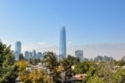
- Windhoek — The Gateway and More
- Sossusvlei and Deadvlei — The Dunes
- Sesriem Canyon and the Namib Desert Park
- Swakopmund — The German Town on the Atlantic
- The Skeleton Coast
- Damaraland — Rhino, Rock Art, and the Desert Elephant
- Etosha National Park — The Self-Drive Safari
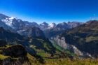
- The Caprivi Strip — When Namibia Meets the Green
- Fish River Canyon — The Second-Largest Canyon on Earth
- The Himba Communities — The Cultural Question
- Hidden Namibia — The Places Most Routes Miss
- What It Costs — Real Numbers
- Eating and Drinking in Namibia
- Practical Notes
- The 14-Day Self-Drive Itinerary
The Case for Namibia — And the Self-Drive Argument
The standard African safari model involves: a lodge, a guide, a Land Cruiser, and game drives twice a day. The experience is extraordinary and the price reflects it — a week at a mid-range safari lodge in Tanzania or Kenya costs £3,000-5,000 per person.
Namibia offers a different model. The country has one of the finest road networks in Africa — tar roads on all major routes, gravel roads that are well-maintained and manageable in a standard 4WD without specialist off-road experience. The national parks and conservancies have excellent self-catering camps and rest camps with pre-booked accommodation. Wildlife viewing in Etosha is done by driving yourself between waterholes, parking at the designated spots, and watching what arrives. No guide required. No guide fee.
A 14-day self-drive Namibia trip — car hire, accommodation in lodges and camps, fuel, park entry, food — costs £1,800-2,500 per person all in from the UK. For comparison: a week-long guided safari in the Serengeti from the UK costs £3,500-6,000 per person.
The landscapes beyond the parks are equally extraordinary and equally accessible by car. Deadvlei and Sossusvlei are reached by a 65km gravel road from the Sesriem gate. The Fish River Canyon is a 20-minute drive from the nearest camp. The Skeleton Coast is driven, slowly, in a 4WD with supplies. The country is built for this.
The case against: distances are significant. Windhoek to Sossusvlei is 340km. Sossusvlei to Swakopmund is 360km. Swakopmund to Etosha is 430km. A 14-day itinerary involves genuine driving days. The reward for those driving days is a country that becomes more extraordinary the further you go.
When to Go — The Dry Season and the Green Season
May to October — The Dry Season
The main travel window. Wildlife concentrates at waterholes as the surface water dries up — making game viewing in Etosha particularly productive from July through September when the Etosha Pan is at its driest. The Sossusvlei dunes are accessible year-round but the dry season gives the clearest skies for sunrise photography. The Fish River Canyon hike is only permitted May through August (flash flood risk closes it November to April). Temperatures: comfortable in the highlands (20-28°C), hot in the desert regions (35-42°C at midday), cold at night in the desert (10-15°C at the Sossusvlei camps).
The best single month: August. Wildlife at its most concentrated. The orange of the desert dunes at maximum intensity before the summer heat builds. The nights cold enough for the campfire to be the social centrepiece.
November to April — The Green Season
Namibia’s rainy season — brief but dramatic rains transform the desert. The Etosha pan floods in good rainfall years, reflecting the sky, and flamingos arrive by the thousand. The Caprivi Strip becomes lush and extraordinary. Bird diversity reaches its peak (November to January in particular). The landscape turns green around Damaraland. The downside: the Fish River Canyon hike is closed, some roads become impassable after heavy rain, and wildlife at waterholes is harder to predict when surface water is available across the park.
January and February in particular are hot (35-40°C across much of the country) and the Sossusvlei region can see rain that makes the dune walks unpleasant.
The BGGD recommendation: July to September for the self-drive wildlife focus. May for the Fish River Canyon hike (cooler, fewer people, permit available). October for a combination of wildlife, landscape, and beginning of the green season rains.
How to Self-Drive — The Honest Planning Guide
Self-driving Namibia is genuinely manageable for travellers with no previous African driving experience. The key framework:
The Car
A 4WD is not optional — it is the correct vehicle for Namibia regardless of whether you’re planning to go off-road. The reasons:
Ground clearance: the gravel roads to Sossusvlei, across Damaraland, and in the Skeleton Coast have sections where rocks in the road require clearance a standard saloon car doesn’t have. Sand crossings at the Deadvlei 4WD car park are impossible without 4WD.
Safety: a 4WD with high clearance handles the corrugated gravel roads (which develop ridges perpendicular to the direction of travel) at the right speed without the instability that lower-profile vehicles experience.
Recommended: Toyota Land Cruiser or Hilux (the reference Namibia vehicle), Toyota RAV4 or Prado (adequate for most routes), any large high-clearance SUV from a reputable hire company.
Car hire companies: Asco Car Hire (Namibian, reliable, well-maintained vehicles), Avis Namibia, Europcar Namibia. All have offices at Windhoek airport. Book 4-8 weeks ahead in peak season. A 14-day 4WD hire with unlimited mileage and basic insurance: £900-1,400.
Tyre kit: most hire companies include a basic spare. Ask specifically for a full-size spare rather than a temporary spare — the distance between potential puncture and the next garage makes a temporary spare a serious problem.
The Roads
Namibia’s roads are classified:
- B-roads (tar): the main national routes, smooth and fast. B1 from Windhoek to the north, B2 to Swakopmund, B4 south to South Africa.
- C-roads (gravel): secondary paved/gravel routes. Most are well-maintained. Speed limit 80km/h but 60-70km/h is the practical speed for comfortable driving on corrugated sections.
- D-roads (gravel): district roads, varying quality. Some are excellent, some require care after rain.
- 4WD tracks: true off-road, only in 4WD and ideally with a guide. The Sossusvlei 4WD park (last 5km to Deadvlei) is the one everyone encounters.
A GPS or downloaded Google Maps offline is essential — many road junctions in the desert are unsigned. Download the Namibia maps offline before arrival.
Fuel
Fuel stations exist in all towns and at Etosha’s rest camps. The gaps between stations on some routes (Damaraland, Skeleton Coast) are significant — carry a 20-litre jerry can on any route more than 250km between towns. Diesel is recommended over petrol for longer range and availability. Check the range of your specific hire vehicle before departure.
Accommodation
The NamibRand Nature Reserve, the NWR (Namibia Wildlife Resorts) rest camps inside national parks, and private lodges in conservancies all require advance booking. In peak season (July-September): book 8-12 weeks ahead. The Etosha rest camps (Okaukuejo, Halali, Namutoni) book out months in advance for peak July-August. Book before you book anything else.
Windhoek — The Gateway and More
Windhoek is the arrival point for most travellers — the international airport is 42km outside the city, manageable by hire car or shuttle. Most itineraries allocate one night in Windhoek and drive out the following morning.
The city deserves slightly more credit. As African capitals go, it’s compact, clean, genuinely safe by city standards, and has a German colonial heritage (Namibia was a German colony from 1884 to 1915, and the legacy is visible in the architecture of the Altstadt) that gives it a character unlike any other African city.
The Christuskirche (Christ Church, 1910) — a Lutheran church in neo-Romanesque and Art Nouveau style that appears on every aerial photograph of the city. The Old Fort (Alte Feste, 1890) adjacent — the city’s oldest building, now a museum covering Namibian history including the 1904-1908 Herero and Nama genocide (the first genocide of the 20th century, perpetrated by German colonial forces). Visiting this history before driving into the country that it shaped is worth the hour.
The Independence Memorial Museum overlooking the city gives context for the period from German colonialism through South African administration to Namibian independence in 1990.
For provisions: the Wernhil Park Mall and the Checkers supermarket on Mandume Ndemufayo Avenue are the most comprehensive places in Namibia to buy supplies before entering parks where shopping is limited. Stock up here: camping food, water (carry 4 litres per person per day as a baseline in the desert), snacks, wine and beer at dramatically lower prices than the park rest camps.
Sossusvlei and Deadvlei — The Dunes
Sossusvlei and Deadvlei are in the Namib-Naukluft National Park, 340km south of Windhoek on a mostly tar road (B1 south, then C19 west). The drive takes approximately 4 hours. The gate (Sesriem) opens one hour before sunrise.
The dunes of the Sossusvlei:
The Namib Desert contains the tallest sand dunes in the world. The dunes of the Sossusvlei reach 300 metres — higher than the Eiffel Tower. They are red: the red comes from iron oxide coating the sand grains, the colour deepening with age (older dunes are darker). In the early morning, when the sun comes from the east and lights only the ridges, the contrast between the lit orange-red and the shadow-dark is the image.
Dune 45:
The most accessible large dune — 170 metres high, 45km from the Sesriem gate, visible from the road and walkable from the car park. The climb takes approximately 45 minutes on the ridge (not the face — the ridge is more stable and the ascent more manageable). The descent: run directly down the face in 4 minutes. The view from the summit: the valley below, more dunes in every direction, the occasional oryx track in the sand below.
Climb at sunrise. The car park fills from 7am — if you arrive at gate opening and drive directly, you’re there before the majority of visitors.
Sossusvlei:
The clay pan at the centre of the dune system — a white surface formed by the evaporation of floodwater that occasionally fills the pan in exceptional rainfall years. The last 5km from the 2WD car park to the Sossusvlei pan are sand — accessible only in 4WD or by shuttle (included in park entry, departs from the 2WD car park every 15-20 minutes). The pan itself is extraordinary in form — the white floor, the red dunes rising on every side — but it’s Deadvlei that provides the defining image.
Deadvlei:
A 1km walk from the Sossusvlei pan, or 2km from the 2WD shuttle drop-off. The white clay pan with the dead camel thorn trees.
The trees died approximately 700 years ago when the river that fed the vlei changed course and the water table dropped beyond the roots’ reach. They have not decomposed since — the climate is too dry. They stand exactly as they stood when they died: black, skeletal, the tallest reaching 30 metres. Around them, the white clay floor. Around the white clay floor, the dunes — the tallest (Big Daddy, the highest dune above Deadvlei, reaching 325m) rising immediately to the west and casting a shadow that moves across the pan as the sun climbs.
At 7am, before the shadow lifts from the pan, the light catches only the dune ridges and the top of Big Daddy. The trees are black against the white floor against the red dune. It is one of the most extraordinary natural compositions on Earth.
At 10am, when the shadow has lifted and the full sun falls on the pan, the white clay bleaches to near-white and the photographs change character completely. Both are remarkable. The early morning version is the one most travellers carry home.
Walk slowly. Sit if you need to. There’s no hurry at Deadvlei. The trees have been waiting 700 years.
Sesriem Canyon and the Namib Desert Park
The Sesriem Canyon — adjacent to the park gate — is a narrow slot canyon carved by the Tsauchab River through 30-million-year-old conglomerate rock. Entry is included in the Namib-Naukluft park fee. A 1km walk takes you through the full accessible section; the deeper inner gorge requires scrambling. At 7am, before the tour groups, the canyon is cool, shaded, and quiet.
The Namib Desert Park beyond Sossusvlei: the gravel road continuing west from the Sesriem gate toward Swakopmund (the C14, then D1998) passes through the Namib’s full landscape — gravel plains, the ephemeral Kuiseb River canyon, the point where the gravel plain meets the sand dunes at an almost geometrically precise line. The drive from Sesriem to Swakopmund through the Namib takes approximately 4-5 hours, passing almost nothing — and the almost-nothing is itself extraordinary.
Swakopmund — The German Town on the Atlantic
Swakopmund sits on the Atlantic coast at the edge of the Namib — a Bavarian-style town of colonial architecture (built 1892-1915) surrounded by desert, the cold Atlantic in front, red sand dunes behind. The temperature is permanently moderated by the Benguela current (which keeps the sea at 12-15°C even in summer) and the fog that rolls inland from it. In the middle of the Namib Desert, Swakopmund is frequently cool enough for a jacket.
The town’s German heritage is tangible and the town’s Namibian present is equally so — the mix of cultures (German-Namibian, Herero, Nama, Oshiwambo-speaking communities from the north) gives it a character unlike any other small coastal town in Africa.
What to do:
The beachfront promenade. The old lighthouse. The Kristall Galerie — a private collection of minerals and crystals from across Namibia, including the world’s largest known natural amethyst (13 tonnes). The Swakopmund Museum covering the pre-colonial, German colonial, and South African administrative history of the region.
Adventure activities: Swakopmund has the highest concentration of adventure operators in Namibia. Sandboarding (surfing the dunes on a board — specifically the dunes immediately east of town, higher and steeper than they look), quad biking on the dunes, kayaking in the Walvis Bay lagoon (15km south of Swakopmund, the largest flamingo congregation in southern Africa — 50,000-100,000 flamingos in the right conditions), and skydiving over the Namib with the ocean and desert visible simultaneously.
The oysters: Walvis Bay’s lagoon produces oysters of extraordinary quality — the cold Benguela water creates slow-growing, intensely flavoured specimens. Grab and Go at the Walvis Bay jetty: order a dozen for approximately £8, eat them standing at the waterfront.
The Skeleton Coast
The Skeleton Coast is the northward-running Atlantic coastline from the Orange River to the Kunene (on the Angolan border), 500km of desert meeting cold ocean. The name: from the whale and seal bones that once covered the shore (the 19th-century whaling industry processed animals here), from the ships that wrecked on the coastline (the cold water, the fog, and the lack of fresh water made shipwreck survival almost impossible), and from the whale-processing and mining machinery that was abandoned and rusts slowly in the desert air.
The accessible Skeleton Coast:
From Swakopmund north to the southern boundary of the Skeleton Coast National Park: a tar and gravel road (C34) runs 280km to Terrace Bay, the northernmost public access point. The drive passes: the Cape Cross Seal Reserve (a colony of approximately 80,000-100,000 Cape fur seals — the largest in the world, the smell arriving 3km before the colony, extraordinary in scale and sound), the Ugabmund River crossing, the fog zone where the desert landscape turns ghostly.
The Skeleton Coast’s fog: when the cold Benguela water meets the hot desert air above the shore, the fog rolls inland. It can be dense enough to reduce visibility to 20 metres. It rolls and shifts, revealing and obscuring the landscape. The shipwrecks (some visible from the road, some reachable on foot) are easier to find in fog than in clear air — something about the reduced visibility makes the scale of them clearer.
The restricted Skeleton Coast:
The northern portion of the Skeleton Coast National Park — the area beyond Terrace Bay — is restricted to fly-in lodges and guided tours only. The Wilderness Safaris and Skeleton Coast Safaris lodges offer the only access. This section (the Hartmann’s Valley, the clay castles of the Hoarusib River mouth, the enormous dune fields near the Kunene) is, by all accounts, one of the most remote and extraordinary landscapes in Africa. It requires a significant budget (£600-1,200/person/night at the lodges) and a domestic flight from Windhoek.
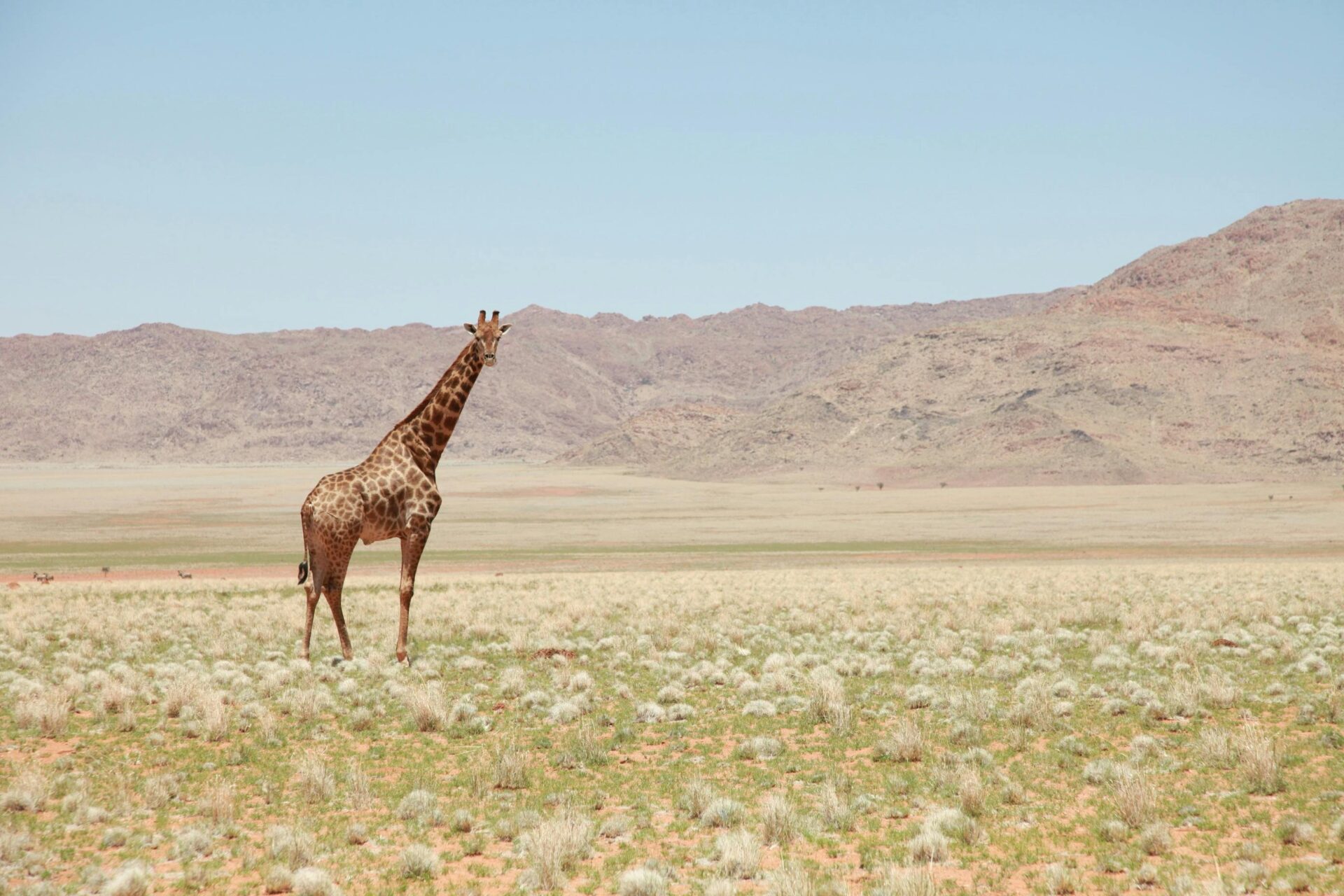
Damaraland — Rhino, Rock Art, and the Desert Elephant
Damaraland is the central-western region of Namibia — a landscape of volcanic outcrops, dry riverbeds, ancient rock engravings, and the desert-adapted elephants that represent the only truly free-ranging elephant population in a desert environment on Earth.
Twyfelfontein — Rock Art
A UNESCO World Heritage site of San (Bushman) rock engravings and paintings — estimated 2,000-6,000 years old, covering the sandstone outcrops of the Twyfelfontein valley with animals (gemsbok, rhino, elephant, lion, seal), human figures, and abstract geometric forms. Entry: £5. A local guide (available at the entrance) provides essential context.
The engravings are the finest San rock art accessible in Namibia — the detail and the density of the imagery across multiple panels gives a sense of what this landscape meant to its inhabitants across thousands of years. Burnside Farm adjacent: the only site in Namibia where you can see both rock engravings and rock paintings from the same San tradition. Extraordinary.
The Desert Elephant
Desert-adapted elephant (Loxodonta africana) in Damaraland represent a separate behavioural lineage — elephants that have adapted to walking 70km between water sources, existing on sparse desert vegetation, and navigating by memory a landscape with no permanent water. The Hoanib and Ugab River valleys are their primary range.
Sightings are not guaranteed — these are wild elephants across a vast territory. The Save the Rhino Trust and Elephant Human Relations Aid both operate in the area and can advise on current sightings. A 4WD drive through the Aba-Huab river valley with a local conservancy guide (£25-35 for the half day) gives the best access.
The Black Rhino
Namibia has the largest population of black rhinoceros (Diceros bicornis) in the world — approximately 1,950 individuals, representing 24% of the global population. The majority live in Damaraland and the surrounding communal conservancies, protected by a combination of government anti-poaching and community conservancy management.
Rhino tracking on foot with a Save the Rhino Trust tracker and guide is one of the finest wildlife experiences available in Africa — a 3-5 hour walk through the desert terrain following signs and tracks, culminating (on successful days) in a close encounter with a free-ranging animal whose population was hunted to near-extinction 40 years ago. Bookable through Palmwag Lodge or the Save the Rhino Trust directly: £85-120/person. Not guaranteed; success rates are high but this is wild terrain.
Spitzkoppe
The “Matterhorn of Namibia” — a granite inselberg (isolated mountain) rising 1,784m from the gravel plains, visible for 100km in every direction. The San rock paintings on the boulders at its base (accessible with a local guide). The campsite below: one of the finest in Namibia — camping directly in the boulder landscape, the granite towering above the tent.
Etosha National Park — The Self-Drive Safari
Etosha is a 22,270 square kilometre national park centred on the Etosha Pan — a vast, flat, white saltpan that was once a shallow lake and is now an extraordinary landscape: white and featureless at its centre, the edges shimmering with mirages, the surrounding woodland where the wildlife lives.
The park model: self-drive. You hire a car, enter the park through one of the three gates (Anderson in the south, Von Lindequist in the east, King Nehale in the north), drive between the designated waterholes, and watch. There are no guides, no guides required, no feeling that you need to be told what you’re looking at. You park at the waterhole. You wait. The animals come.
The waterholes:
This is what makes Etosha different from most African safari parks. In the dry season, as the surface water across the park disappears, the few remaining permanent waterholes (some natural, some artificially maintained by the park) become the only water source for miles. Every animal in the surrounding area comes to drink. The waterholes at Okaukuejo, Halali, and Namutoni rest camps are floodlit at night — you sit at the viewing blind after dinner and watch the parade.
What comes to drink:
Elephant — the Etosha population (around 2,800) is one of the largest in southern Africa. Herds arrive at waterholes in dust-raising columns. Black rhino — Etosha has the finest black rhino viewing on earth; the Okaukuejo waterhole in particular has near-nightly rhino appearances. Lion — the Etosha lion population (around 500) hunts at waterholes in the night. Leopard, cheetah, spotted hyena, African wild dog, giraffe, zebra, blue wildebeest, springbok, gemsbok — the waterhole attendance list is the mammal checklist of southern Africa.
The floodlit night waterhole at Okaukuejo:
Sitting at the Okaukuejo waterhole at 10pm in August: the pan is lit by floodlights. A herd of 40 elephants arrives from the east. Then, from the south, a black rhino — cautious, smelling the air, approaching by increments. The two species tolerate each other at the water’s edge with a wariness born of long familiarity. The lion that arrived at 11pm lies in the shadow of the far bank, watching.
Nothing is staged. The floodlights are fixed. The animals use this waterhole because it has water, not because there’s an audience.
Book the Okaukuejo rest camp and position yourself at the waterhole every evening from sunset. It is the finest wildlife experience I’ve had in Africa.
The rest camps:
Three main rest camps inside the park:
- Okaukuejo (Anderson Gate, southern camp): the most famous, with the best waterhole. Accommodation: chalets, camping, bungalows. Book 10-12 weeks ahead for peak season.
- Halali (central): smaller, quieter, good waterhole. Fewer visitors than Okaukuejo.
- Namutoni (eastern, Von Lindequist Gate): a former German fort converted to a rest camp. The Nama waterhole nearby has excellent lion activity. Fischer’s Pan to the east fills in exceptional rainfall years and attracts flamingo.
Entry fees: £8/person/day, £5/vehicle/day. Included in these fees: unlimited driving within the park during daylight hours.
The Caprivi Strip — When Namibia Meets the Green
The Caprivi Strip is a narrow finger of land in northeastern Namibia, drawn by colonial treaty to give German South West Africa access to the Zambezi River. It’s 450km long and between 30-100km wide, surrounded by Botswana, Zambia, Zimbabwe, and Angola — and it is entirely different from the rest of the country.
Where Namibia’s south and west are defined by desert, the Caprivi is subtropical — the Okavango, Kwando, Chobe, and Zambezi rivers all flow through the strip. The vegetation is thick: mopane woodland, papyrus channels, floodplains. The wildlife: hippo, Nile crocodile, buffalo, elephant, and lion in genuinely different landscape from the Etosha savannah.
Mudumu and Bwabwata National Parks in the Caprivi are the primary wildlife areas — with none of the rest camp infrastructure of Etosha, replaced by smaller private lodges on the river banks.
The Caprivi is a multi-day addition to a Namibia itinerary rather than a primary destination — it’s most naturally combined with a Botswana extension (the Okavango Delta and Chobe are both directly adjacent) or as a self-contained river-and-game experience for travellers who want to see a completely different Namibia.
Fish River Canyon — The Second-Largest Canyon on Earth
In the south of Namibia, 850km from Windhoek: the Fish River Canyon. 160km long. Up to 27km wide. 550 metres deep at the main viewpoint.
It is the second-largest canyon on Earth after the Grand Canyon. It receives a fraction of the Grand Canyon’s visitors.
The viewpoint:
The main viewpoint (Hobas visitor centre area) gives the full vista: the canyon floor 550 metres below, the Fish River winding through the green vegetation of its banks, the canyon walls layered in geological strata that represent 1.8 billion years of Namibian rock history. The scale takes a few minutes to process — the eye keeps offering interpretations that are smaller than the actual dimensions.
Standing at the rim in the late afternoon when the shadows begin to reach across the canyon floor: one of the great landscape views in southern Africa, with a fraction of the Grand Canyon’s crowd in attendance.
Entry: £5/person. The main viewpoint is 5km from the Hobas camp on a tar road.
The Fish River Canyon hike:
The most challenging multi-day hike in Namibia and one of the finest in southern Africa. 85km along the canyon floor, from Hikers’ Point in the north to Ai-Ais hot springs in the south. 4-5 days. Unmaintained trail, no camping infrastructure, pack everything in and out.
Permits: available May through August only (flash flood risk in the rainy season). The permit requires a medical certificate of fitness, issued within 40 days of the start date, obtained from a registered doctor. £25/person. Capacity is limited — book 3-4 months ahead for July and August.
The trail: the canyon floor is rocky and the pace is determined by the terrain rather than the distance. Day 1 (22km from Hikers’ Point) is the longest and hardest. The canyon geology changes character as you move south — narrows, wide pools, the hot springs at Ai-Ais at the end.
The pools: the Fish River flows through the canyon year-round at varying levels. The rock pools at bends in the river are swimmable in the cool morning. Some hikers carry a small lightweight towel and nothing else in the way of luxuries — the canyon is hot during the day regardless of the season.
The Himba Communities — The Cultural Question
The Himba are a semi-nomadic pastoralist people of northwestern Namibia (Kunene region) — approximately 50,000 people who have maintained a traditional lifestyle characterised by a specific aesthetic (the women cover their skin and hair in otjize, a mixture of red ochre and butterfat, giving them the distinctive appearance that appears in every photographic account of Namibia) and a society organised around cattle ownership, seasonal migration, and ancestral worship.
Tourism involving Himba communities is genuine and genuinely complex.
The honest position:
Himba communities in Opuwo and the surrounding Kunene region welcome visitors in contexts that are directly beneficial to the community — where entry fees go to the community, where the visit is mediated by a community guide rather than an outside operator, and where the interaction is reciprocal rather than observational.
The “staged village” visits — where communities have set up designated tourism villages that exist primarily for visitor photography — exist and are the less authentic version. They’re also not wrong per se: the community has chosen to participate in tourism and is earning from it.
What actually works:
Booking a tour through Opuwo Country Lodge or through Namibia Tourism Board-registered operators who work directly with specific Himba communities on a community-benefit basis. These typically cost £25-40/person for a half-day. The community guide sets the terms of the interaction. Photography is possible with explicit permission, which is given specifically to the guide and communicated to the group.
The alternative: driving the C43 through the Kunene region, stopping at trading posts where the interaction is incidental rather than organised, gives a less structured but sometimes more genuine encounter. No photography expectation, no fee, just the exchange that happens when you buy something from a market stall.
Hidden Namibia — The Places Most Routes Miss
The Quiver Tree Forest (Kokerboom Woud)
Near the town of Keetmanshoop, 8 hours south of Windhoek: a stand of 250 quiver trees (Aloe dichotoma) — ancient succulent trees, 2-3 metres in diameter at the base, their hollowed branches used by San people for quivers. The trees date from 200-800 years old. At night, with the Milky Way above and the trees’ silhouettes below: one of the finest astrophotography compositions available in Africa.
Entry: small community fee from the farm that manages the forest. Camp adjacent at the farm — the night sky is extraordinary.
The Naukluft Mountains
The Naukluft Massif is a plateau of dolomite mountains in the centre of the Namib-Naukluft Park — harder to access than Sossusvlei but with extraordinary hiking routes including the 120km Naukluft Trail (8 days, requires advance booking with NWR). The day hikes from the Naukluft camp give access to a landscape — springs, canyon, klipspringer antelopes on the rock faces — that almost no Namibia visitors reach.
The Brandberg and the White Lady
The Brandberg is the highest mountain in Namibia (2,573m), an isolated granite massif in the northern Namib visible from 50km in every direction. The Tsisab Ravine trail leads to the White Lady rock painting — a San masterwork, 4,000 years old, showing a white human figure in a procession of animals and figures whose full meaning is still debated. The hike with a local Damara guide takes 3 hours return. The painting site is extraordinary both as art and as landscape. Book the guide at the Brandberg White Lady Lodge.
The Orange River
The southern border with South Africa, where the Orange River runs through a canyon above the Namibia-South Africa border. Canoe trips on the Orange River (3-5 days, camping on the riverbanks, the canyon walls above) are organised from the Namibia side by Felix Unite and Koru Kayaking. The river is slower than the canyon terrain suggests — paddling between canyon walls with fish eagles overhead, camping on sandy banks where no roads reach, is one of the great river experiences in southern Africa.
What It Costs — Real Numbers
The self-drive model changes the cost structure of Namibia significantly from a guided lodge safari. The main costs are car hire, fuel, and accommodation — with park entry fees and food as secondary expenses.
The Fuel Reality
Namibia requires fuel planning. A typical 14-day self-drive itinerary covers 4,000-5,000km. A 4WD Land Cruiser or Hilux averages approximately 10-12 litres per 100km on gravel roads. At Namibia fuel prices (approximately £1.10-1.20/litre for diesel), the fuel cost for the full itinerary is £440-600.
Fill every time you see a petrol station. Carry a 20-litre jerry can on any route more than 200km between towns.
Daily Budgets
Budget — Self-Drive Camping (£40-55/day)
- Accommodation: NWR rest camp chalets or camping (£15-30/night at most rest camps)
- Food: self-catering from Windhoek provisions plus rest camp restaurants for one meal
- Park entry: amortised across the trip
- Car hire and fuel: amortised separately (see below)
Mid-Range — Mix of Lodges and Camps (£80-110/day)
- Accommodation: private lodges with dinner and breakfast (£60-100/night)
- Food: lodge included plus self-catering for lunch
- Activities: guided rhino tracking, canoe trips
Comfortable — Private Lodges (£150-250/day)
- Accommodation: mid-range private lodges (£100-200/night full board)
- Activities: full programme included
What 14 Days in Namibia Actually Costs from the UK
| Category | Budget (camping) | Mid-Range (mix) |
|---|---|---|
| Return flights (Windhoek, via Johannesburg) | £650–850 | £750–950 |
| Car hire 14 days (4WD, unlimited km) | £900–1,200 | £900–1,200 |
| Fuel (4,500km, diesel) | £500–600 | £500–600 |
| Park entry fees (Etosha, Namib-Naukluft, Fish River) | £80–120 | £80–120 |
| 14 nights accommodation | £250–400 | £700–1,200 |
| Food (self-catering + 4 restaurant meals) | £120–180 | £200–300 |
| Activities (rhino tracking, Cape Cross, guided sites) | £80–140 | £120–200 |
| Total | £2,580–3,490 | £3,250–4,570 |
Namibia is not a budget destination — the distances and the car hire make it more expensive than SE Asia or Eastern Europe. It is, however, significantly cheaper than a guided lodge safari in Tanzania or Kenya for equivalent or greater landscape experience.
Eating and Drinking in Namibia
Namibia’s food culture reflects its German colonial heritage, its indigenous Namibian communities, and its position as a cattle-farming nation in southern Africa. It is not the reason to visit Namibia. It is, however, better than its reputation suggests.
Braai: the communal barbecue — the social event of Namibian outdoor life. Every rest camp and lodge has braai facilities. Namibian beef (grass-fed, from one of the world’s finest cattle-ranching environments) is excellent. Oryx (gemsbok) appears on many menus — lean, dark, with a flavour somewhere between venison and beef.
Kapana: street barbecue at the Katutura township market in Windhoek — offal and tougher cuts cooked on open grills, chopped with a cleaver, eaten with peri-peri sauce and fresh bread. The best lunch in Windhoek for £2-3 and the most genuinely local food available in the country.
Biltong: dried cured meat (beef, kudu, gemsbok) — the correct road snack for a Namibia self-drive. Buy it at any supermarket in Windhoek before departure. The kudu biltong is the finest version.
Potjie: slow-cooked stew in a three-legged cast iron pot, available at most lodges for dinner. The game meat version (oryx, springbok) with dried fruit and spices is the Namibian variation on the South African original.
Walvis Bay oysters: as described in the Swakopmund section — a dozen for £8, eaten fresh at the jetty. The reason to stop in Walvis Bay regardless of the rest of the agenda.
The Lodge Breakfast: Namibian lodge breakfasts are typically substantial — eggs cooked to order, meats, cheese, fresh bread, cereal, fruit, juice. The NWR rest camp breakfasts are simpler. Building breakfast into the lodge rate rather than self-catering it saves planning and usually costs less than the room-only rate implies.
Beer: Windhoek Lager — produced in Windhoek since 1920 under the German purity laws the German settlers brought with them. Genuinely excellent cold beer. Available everywhere in the country.
Practical Notes
Visa: No visa required for UK passport holders. Stamp on arrival at Windhoek International Airport or any land border. Stays of up to 90 days permitted.
Getting there: No direct flights from the UK. Main routing: via Johannesburg on British Airways or South African Airways (connecting to Windhoek on Airlink or SA Express, total journey 12-14 hours). Via Addis Ababa on Ethiopian Airlines (connecting to Windhoek, slightly longer). Return flights from approximately £650-950 booked 8-12 weeks ahead.
When you land: Windhoek’s Hosea Kutako International Airport (WDH) is 42km east of the city. Collect your hire car at the airport. Buy provisions in Windhoek before driving — this is the most important first-day task for a self-drive itinerary.
Currency: Namibian Dollar (NAD), pegged 1:1 to the South African Rand (ZAR). South African Rand is also accepted as legal tender throughout Namibia. £1 ≈ 23 NAD at time of writing. ATMs in Windhoek, Swakopmund, Otjiwarongo, and Lüderitz. Carry cash in the parks and remote areas — card facilities are unreliable outside cities and major lodges.
Mobile coverage: Namibia has two main networks (MTC and TN Mobile). Coverage exists in all towns and along the main B-roads. No coverage in the Namib-Naukluft Park interior, the Skeleton Coast, or much of Damaraland. Download Google Maps offline for the full country before departure. Do not rely on navigation apps requiring data in the field.
Getting a SIM: MTC SIMs available at the airport and in Windhoek. A tourist SIM with 5GB data costs approximately £8-10. The SIM is useful for Windhoek, Swakopmund, and the North — not for the remote drives between.
Safety: Namibia is one of the safest countries in Africa for travellers. The main risks are: road accidents (wildlife on unfenced roads, particularly at night — do not drive after dark on gravel roads), dehydration (carry 4 litres per person per day minimum in the desert), and vehicle breakdown in remote areas (carry a spare tyre, jump leads, and a basic tool kit). Wildlife proximity: follow park guidelines, do not exit the vehicle in the open bush except at designated stops.
Emergency contact: Namibia’s emergency number is 10111 (police) and 10177 (ambulance). The NWR emergency line for park incidents is posted at all rest camp offices. A satellite communicator (SPOT or Garmin InReach) is worth renting for the most remote sections (Skeleton Coast, Damaraland interior).
The 14-Day Self-Drive Itinerary
This route covers the core Namibia self-drive circuit — Windhoek south to Sossusvlei, north to Swakopmund and the Skeleton Coast, east through Damaraland, north to Etosha, and return to Windhoek. Total distance: approximately 4,500km. The route is circular — you fly in and out of Windhoek.
Day 1: Windhoek Land. Collect hire car. Provision at Checkers supermarket. One night in Windhoek (Klein Windhoek guesthouses from £60/night). City visit: Christuskirche, Old Fort, Katutura kapana market for lunch.
Days 2-3: Sossusvlei and Deadvlei Drive south from Windhoek on the B1, west on the C19 to Sesriem (340km, 4 hours). Arrive by 3pm. Drive to the Sesriem Canyon (5km, included in park entry). Sunset at the nearby dune viewpoint. Camp or lodge at Sesriem.
Day 3: Gate opens one hour before sunrise. Drive to Dune 45. Climb the dune. Drive to the 2WD car park. 4WD shuttle or drive to Deadvlei. Walk the 1km to the pan. Stay as long as needed. Return by noon. Drive back to Sesriem for the night. Second sunrise at Deadvlei if staying two nights.
Day 4: Solitaire and Namibia Desert Drive Leave Sesriem. Drive the C14 northwest through the Namib toward Swakopmund (360km, 5-6 hours). Stop at Solitaire — a single petrol station with the finest apple pie in Namibia and a graveyard of rusted cars in the surrounding desert. Continue through the Kuiseb Canyon. Arrive Swakopmund by late afternoon.
Days 5-6: Swakopmund and Walvis Bay Day 5: Walvis Bay oysters at the jetty. Flamingo viewing from the lagoon road. Afternoon: Swakopmund town, the Kristall Galerie, the beachfront promenade. Day 6: Adventure day — sandboarding at the dunes east of town (book through the Swakopmund Tourism Office), afternoon free.
Day 7: Skeleton Coast Drive north on the C34 to Cape Cross Seal Reserve (120km, 2 hours). The seal colony. Continue north to Henties Bay for the night, or return to Swakopmund. The Skeleton Coast drive north of Cape Cross is accessible on a day return.
Days 8-9: Damaraland Drive northeast from Swakopmund through the Brandberg region to Twyfelfontein (300km, 4.5 hours). Afternoon: Twyfelfontein rock engravings with a local guide. Drive to the Aba-Huab valley for desert elephant sightings (self-drive or with conservancy guide). Accommodation: Damara Mopane Lodge or camping at Twyfelfontein.
Day 9: Rhino tracking with Save the Rhino Trust guide (book ahead, £85-120/person, half-day). Drive to Palmwag area for the night.
Days 10-12: Etosha National Park Drive north from Palmwag to Etosha’s Anderson Gate (180km, 3 hours). Enter the park. Drive to Okaukuejo camp. Evening waterhole viewing (sunset and night session).
Day 11: Full day self-drive around the Etosha Pan southern circuit — Ombika, Gemsbokvlakte, Chudob, and the Okondeka area (lion territory in the west). Return to Okaukuejo or Halali for the night waterhole.
Day 12: Drive the central circuit (Halali to Namutoni, stopping at Fischer’s Pan, Tsumcor, Kalkheuwel). Namutoni overnight. Night waterhole for rhino viewing.
Day 13: Etosha to Waterberg Exit via Von Lindequist Gate (east). Drive south to Waterberg Plateau Park (170km, 2.5 hours). Self-guided walk on the plateau for cheetah, sable antelope, white rhino. Overnight at Waterberg Camp.
Day 14: Return to Windhoek Drive south from Waterberg to Windhoek (180km, 2.5 hours). Return hire car at airport. Evening flight home.
Final Thought
I was at Deadvlei at 6:45am. The shadow of Big Daddy dune still covered half the clay pan — the line between light and shadow sharp enough to mark with a finger, the lit half orange-white, the shadowed half a cooler grey.
One of the dead trees was directly on the line. The sun was climbing the dune behind it. Over the next 15 minutes, the light crossed the tree from base to crown.
There were four other people in the whole pan. We didn’t speak. There was nothing to say that the place wasn’t already saying.
The tree died 700 years ago. In the dry climate of the Namib it will stand for another 700. Long after anything I write about it has become irrelevant, it will still be standing on that line, waiting for the light.
Question about Namibia this guide doesn’t cover? Drop it in the comments.